The Pacific Crossing
Mexico to the Marquesas
March 24, 2002
On this date, Final Straw left Paradise
Village in Puerto Vallarta to
cross the Pacific. Aboard was our crew of four, with good representation of
both experience and strength. A crew of four is ideal on a long passage like
this. It allows for shorter watches and an opportunity for rest and relaxation.
Since someone needs to be "on watch" at all times, 24 hours per day,
having four crew aboard means each person would be "on watch" for
three hours and "off watch" for nine hours, two times per day! That
makes life at sea pretty easy and a lot more fun.
Our crew for the crossing leg from Puerto
Vallarta to the Marquesas consisted of the following:
- Terry Willis, who
had already accompanied us from San Diego to PV in January 2001. Terry has
done many yacht deliveries along the West coast and obtained his USCG 100
ton Master’s license by the time we made the trip.
- John Prentice, an
experienced racer and cruiser and current owner of the famous racing boat
Scarlet O’Hara. John joined us for the personal experience of a South Pacific
crossing. He’s done several Transpac races (LA to Honolulu) and plans to
make this same crossing in Scarlet in 2004.
- Kevin Straw,
designated First Mate, surfer, adventurer and all around strong aquatic
athlete. It was great to be able to have Kevin join us. He put his work at
Mission Bay Aquatic Center aside and stayed with us all the way to New
Zealand. He was tremendous help to Suzy and me. He was willing to do the
hard work and go on deck in nasty weather to secure a line, etc. He was
always the one that jumped in at an anchorage to check the set of the
anchor. We really enjoyed having him with us. When he got back to San
Diego in 2003, he passed the test for his USCG Master’s license.
- Clark Straw, owner
and Captain of Final Straw. This passage was the fulfillment of many years
of dreaming about crossing the Pacific and visiting the islands along the
Coconut Milk run on my own boat. It involved many year’s of preparation
which culminated in securing a USCG 100-ton Master’s license in July 2000.
So, needless to say, we had a really
good team of four!
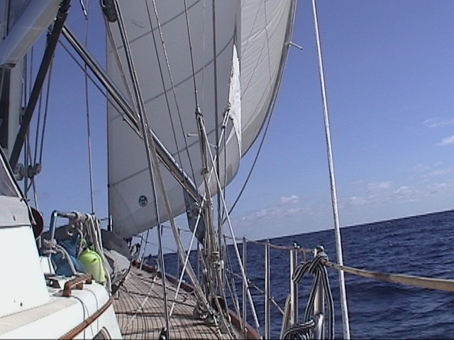
Final Straw underway in early stages
This leg of our trip is by far the longest.
It’s 2800 miles! At one point, you find yourself completely out in the middle
of nowhere, 1400 miles from land, which is the farthest point away from terra
firma anywhere on the planet. It’s a long way from help! To keep in touch with
the rest of the world, we used e-mail through the Winlink system and HF radio
extensively. This allowed us to stay in contact with other cruisers, to obtain
critical weather information and to update our boat position directly to the
internet so friends and family knew where we were on a daily basis.
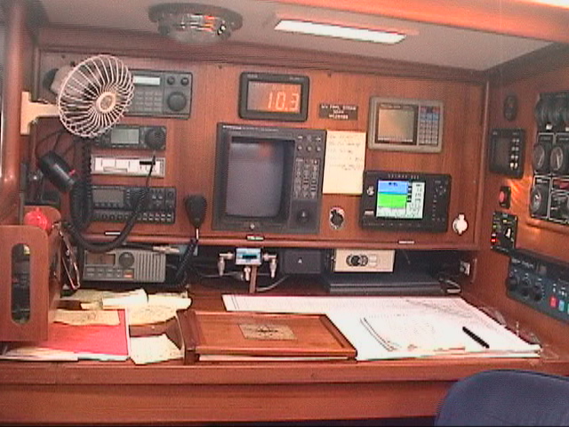
Nav Station - Control Central!
To help facilitate all of this, we joined The Pacific
Seafarer’s Net which meets every
evening at 0330 UTC on 14.313 MHz. These dedicated hams volunteer their time to
track the Pacific ocean crossings of small boats. Their invaluable contribution
adds to the safety, security and comfort of an undertaking like this. We joined
the roll call and gave them our position and additional information about course,
speed and local weather observations each night. It became an enjoyable ritual
to listen to the other check-ins and see how everyone did on their day’s run.
The Net also provided a telephone patch service so we could actually talk home
(for free, I might add) despite the fact we were thousands of miles out to sea!
Below, is a copy of the map which shows the track of Final Straw’s actual
position as we crossed the Pacific. This appeared on the Pacific Seafarer’s Net
website and was available to anyone keeping up with our progress.
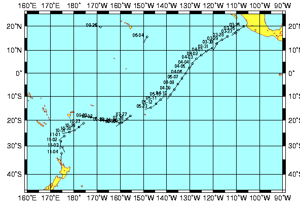
Final Straw's position from PSN website
Just a few comments about the chart above.
The numbers represent the date we reported our position. The direction of the
line shows our course heading. The length of each small line represents our
relative speed. The breaks in data are the shorter legs on our passage where we
were at sea less than 48 hours and didn’t join the PSN roll call. The long
lapses in time represent the time we were at island anchorage’s. And the two
data points up near Hawaii were data entry mistakes where someone transposed
our South latitude to North latitude (a common mistake for Americans used to
using northerly latitudes)!
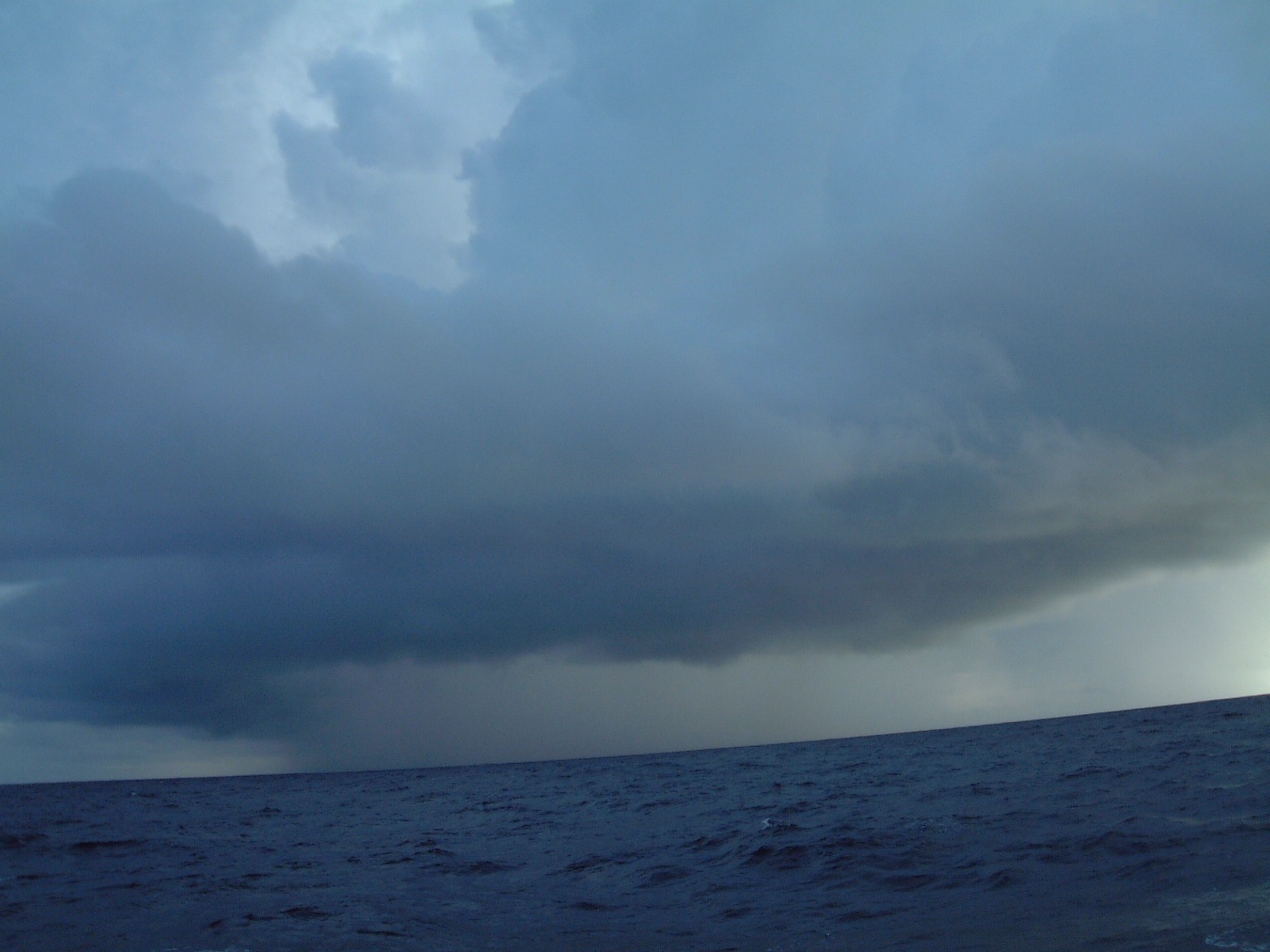
During this leg, we had generally good
weather and wonderful trade winds. There was an occasional squall. But nothing
too serious.
What we did see often were incredible
sunsets!
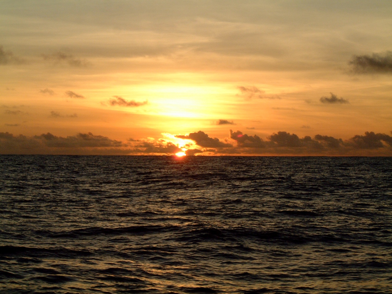
Another beautiful Pacific sunset
March 30, 2002
As we got closer to the
equator, Terry and I were sharing a watch. We were laying back and just looking
up at the stars. It was close to midnight and we were doing well over 7 knots
on a beautifully clear night. The moon was just beginning to rise behind us.
Off to starboard we could clearly see the Big Dipper. And, to port we saw, for
the first time on our trip, the Southern Cross. I just had to play Crosby
Stills & Nash on the stereo:
"Got out of town on a boat goin'
to Southern islands.
Sailing a reach before a followin' sea.
She was makin' for the trades on the outside,
And the downhill run to Papeete.
Off the wind on this heading lie the Marquesas.
We got eighty feet of waterline nicely making way."
"When you see the Southern Cross
for the first time
You understand now why you came this way
'Cause the truth you might be runnin' from is so small
But it's as big as the promise, the promise of a coming day."
- lyrics from Southern
Cross by Crosby, Stills & Nash
How appropriate it was as we
headed for the Marquesas on the same track they took years before when the song
was written.
April 5th, 2002
We made it to the equator in twelve days. We crossed
early this evening and recorded the ceremony on video. We paid homage to King
Neptune for our safe journey so far and watched the GPS flip it’s N to an S as
we traveled from the Northern to Southern hemispheres across the imaginary line
that separates the two.
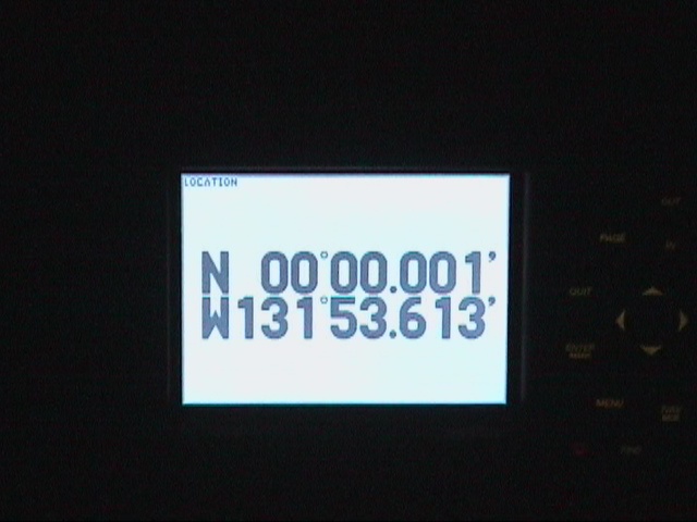
GPS reading as we crossed the
equator
Our 2800 mile passage was pretty fast thanks to some
innovation by Terry and John to try using double headsails in the tradewinds
coming off our starboard aft quarter. The idea was to tie a block at the end of
the boom and use it to hold the spinnaker sheet outboard on the starboard side.
On the port side, we poled out the jib in a standard wing n’ wing
configuration. For stability and to minimize roll, we triple reefed the
mainsail. This combination worked spectacularly well and we had our best daily
runs when we could use this configuration. Unfortunately, we paid for it one
night when we were hit by a squall with all this sail area up. It naturally
happened at 2:30 am and it took all hands on deck to get the big spinnaker down
before something broke. Fortunately, we were successful!
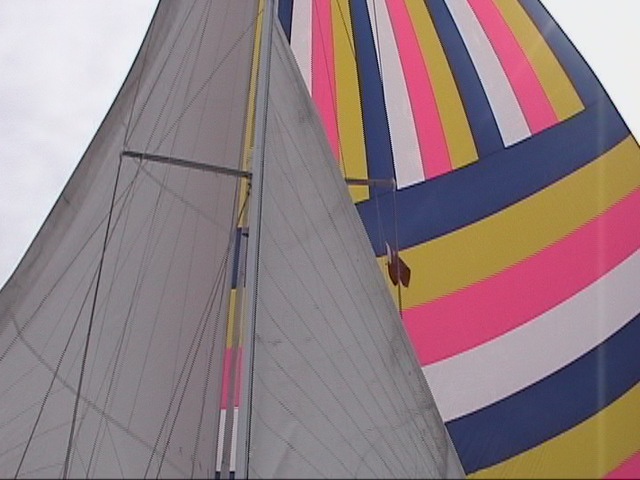
Twin headsails on Final Straw
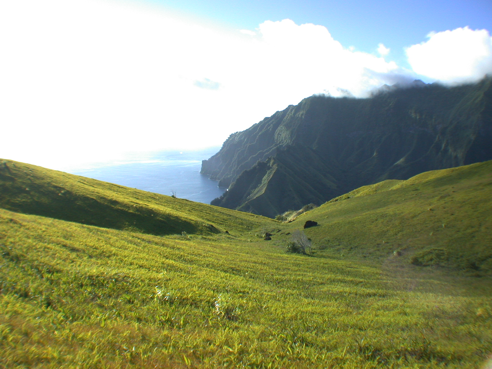
April 9, 2002
After 16 days and 23 hours at sea, we finally saw
land! Ahead of us was beautifully green Hiva Oa!
To continue the adventure on to the Marquesas, click here!
To go back to the home page, click here!